Loading map…
Open Source · Switzerland & worldwide

The living wind map for kitesurfers and paragliders.
Six station networks, 7-day forecasts, 5-year archives.
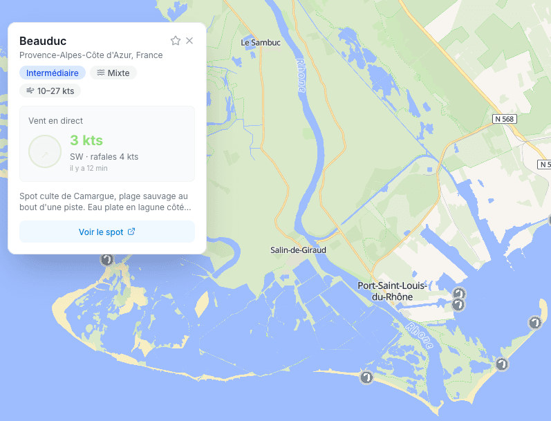
A worldwide map aggregating six real-time weather station networks. Arrows show direction, colour shows strength, and a halo pulses when it's blowing.
Updated every minute, no account needed.
No need to juggle ten websites. Openwind unifies the main public and community networks.
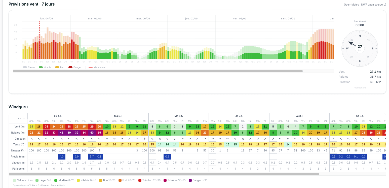
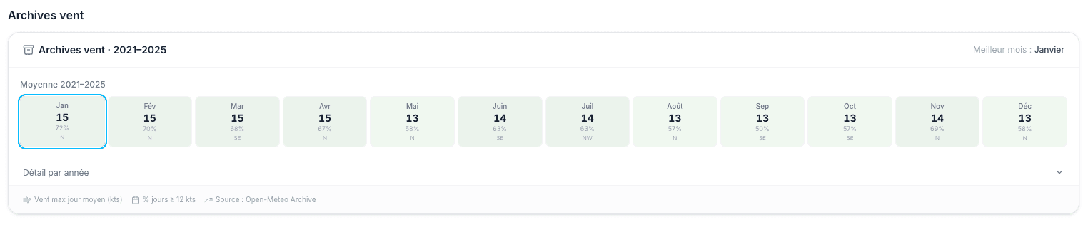
7-day forecasts by hour, and 5 years of archives to confirm a spot's seasonality
Open-Meteo for global coverage, MeteoSwiss ICON-CH2-EPS for Switzerland
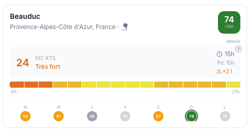
Looking for a session this weekend? Set your dates, range and sport. Openwind scans all nearby spots and tells you where the wind will really blow — ranked by multi-criteria score.
Beyond 16 days, we switch to historical archives for longer trips.
Openwind is 100% open source. The code, data, technical choices — all on GitHub. You can read, fork, contribute.
The forum is for questions: a weird station?, a missing spot?, a feature that would save you time?
A kitesurfer wants wind, a paraglider avoids it. Openwind adjusts its scoring and filters to the chosen sport.
Code, data, models: all public. You can contribute a spot, a station network, a fix — or just read the code to understand how it works.